
Crop health and drought conditions can vary greatly from one area to another. For farmers and agricultural organisations, checking every field regularly can take a lot of time. Manual inspections may also miss early changes that are difficult to see from the ground. Satellite intelligence gives a more comprehensive picture of land used for farming.
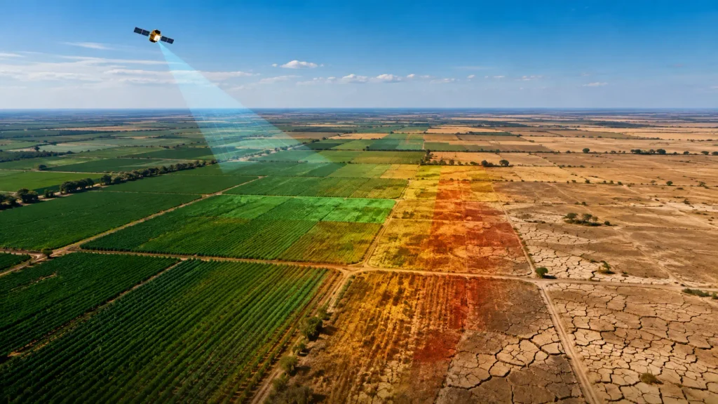
Satellite images and environmental data can aid in monitoring the condition of the vegetation, monitor changing conditions for crops, and help identify areas susceptible to drought. These data can assist farmers in organizing field inspections, managing resources, and reacting to changes in conditions more efficiently. Vision Tech combines satellite imagery, environmental data, and data intelligence to support crop-health and drought monitoring across large areas.
What Is Satellite Intelligence in Agriculture?
Satellite intelligence in agriculture means using satellite images and environmental data to monitor farmland, crop health, and changing growing conditions. It can help agricultural teams observe vegetation, moisture patterns, and land changes across large areas.
This technology has developed over many years. Satellite-based land monitoring expanded after the Landsat programme began in 1972. Today, improved sensors and AI make it easier to analyse agricultural conditions and compare changes over time.
How Does Satellite Crop Monitoring Work?
Satellite crop monitoring provides a wider view of farmland and helps agricultural teams understand how conditions are changing over time. The process generally works in five steps:
- Satellites capture images of agricultural land
Satellites regularly collect images of fields and surrounding areas. This makes it possible to monitor large areas without inspecting every part of the land in person. - Sensors collect information beyond standard photographs
Satellite sensors measure different types of light reflected by crops, soil and water. This information can reveal changes in vegetation that may not be easy to see with the human eye. - The collected data is processed
The satellite images are combined with relevant environmental data and prepared for analysis. - AI identifies changes and unusual patterns
AI models compare the information across different locations and periods. They can highlight possible crop stress, declining vegetation health or areas that may be affected by dry conditions. - The findings are presented clearly
The results can be displayed through maps, reports, alerts or existing agricultural applications. Farmers and crop managers can then use these insights to decide which areas need closer inspection or attention.
What Can Satellite Intelligence Monitor?
Satellite intelligence can assist farmers in monitoring the land, crops, and environmental conditions across vast areas. When comparing satellite images with data over time, it is easier to recognize the changes that might require more scrutiny.
Vegetation Health
Satellite imagery can use the Normalised Difference Vegetation Index (NDVI), which analyses reflected red and near-infrared light to estimate vegetation greenness and condition. This can help identify areas that may be experiencing drought, heat, or other stress. Field inspections are still needed to confirm the exact cause.
Crop Growth Patterns
Satellite images collected at different stages of the growing season can show how crops are developing. Comparing these images helps agricultural teams observe growth patterns and identify areas that are developing differently from the rest of the field.
Drought Conditions
Satellite monitoring may reveal changes in the health of vegetation and other indicators of dry conditions. When paired with data on the environment as well as predictive models, the findings can aid in the monitoring of drought and preparation.
Surface Wetness and Moisture Patterns
Depending on the sensor and data source, satellite observations may reveal broader moisture and surface-wetness patterns across agricultural land.
Heat and Temperature Stress
Environmental and thermal data can help identify areas experiencing unusually high temperatures. Agricultural teams can use this information alongside field observations to determine whether crops may be affected by heat stress.
Land-Use Changes
Satellite imagery can track changes in cultivated fields, unused land, and surrounding areas. This information can support agricultural planning, environmental monitoring, and long-term land management.
These insights can help users identify possible concerns, but they should not be treated as a complete diagnosis. Important crop and land-management decisions should also consider field inspections, local conditions, and professional agricultural advice.
How Satellite Intelligence Supports Crop-Health Monitoring
Satellite intelligence helps agricultural teams monitor crop conditions across large areas without inspecting every field first. It can help teams:
- Identify unusual vegetation patterns
- Compare crop conditions across different locations
- Monitor changes throughout the growing season
- Prioritise areas for field inspection
- Support irrigation and resource planning
For example, if a satellite map shows declining vegetation health in one field, the agricultural team can inspect that area first. The inspection can help determine whether the change is caused by water stress, crop disease, or another local condition.
How Satellite Data Helps Monitor Drought
Drought can develop gradually and affect each area differently. Satellite data can help agricultural teams:
- Monitor changes in vegetation
- Compare current conditions with historical data
- Identify areas that may be at greater risk
- Track whether dry conditions are improving or worsening
- Plan inspections and allocate resources
Climate data intelligence can provide additional context for monitoring environmental and drought-related changes. For a clearer understanding of drought conditions, satellite findings should be considered alongside weather information, soil measurements, and field inspections.
Satellite Monitoring vs Traditional Field Inspection
Satellite monitoring and field inspections serve different but complementary purposes. Satellite data gives a wide picture of the crop’s conditions, and an inspection in person will help confirm what’s happening in the specific region.
| Area | Satellite monitoring | Field inspection |
| Coverage | Monitors large areas at once | Focuses on selected locations |
| Frequency | Provides regular observations | Depends on staff and available time |
| Past comparison | Allows images to be compared over time | Relies on notes, photos and previous records |
| Level of detail | Reveals wider patterns and changes | Provides detailed, ground-level information |
| Best use | Identifies areas that may need attention | Confirms conditions directly in the field |
Benefits of Satellite Intelligence for Agriculture
- Monitor farms and agricultural areas across multiple locations.
- Prioritise field inspections based on observed changes.
- Support irrigation, labour and resource planning.
- Compare present conditions with historical observations.
- Prepare earlier for developing dry conditions.
- Focus attention on areas that may require support.
Limitations of Satellite Monitoring
Satellite monitoring provides useful information, but it also has some limitations:
- Cloud cover: Clouds, smoke, and heavy rain can block clear satellite images.
- Image resolution: Some images may not show small problems within a field.
- Update frequency: New images may not always be available when conditions change.
- Different crop stages: Results may vary depending on the crop type and its stage of growth.
- Limited ground-level detail: Satellite data can show where a change is happening, but it may not explain the exact cause.
- Need for local data: Weather reports, soil measurements, and field observations are often needed for a clearer understanding.
- Possible data errors: The quality of the results depends on the satellite images, data sources, and analytical models used.
Discuss Your Crop-Monitoring Requirements
Vision Tech is a New York-based technology company with more than seven years of innovation in AI and satellite-data integration. Its climate solutions combine multispectral satellite imagery, environmental data, and predictive analytics to support crop-health and drought monitoring.
The team can assess your location, monitoring area, data availability, and reporting needs before recommending a suitable solution. Contact Vision Tech to discuss your agricultural monitoring requirements.
Call: +1 718-421-2076
Who can use satellite crop and drought monitoring?
Farmers, agricultural companies, crop consultants, government agencies, insurance companies, and organizations managing large areas of land for farming can benefit from monitoring satellites. It will help them monitor the condition of their crops, pinpoint areas that might require inspection, and plan the best way to use resources.
Can satellites detect drought before crops are severely affected?
Satellite data may reveal changes in vegetation health, surface temperature, and moisture patterns linked to developing dry conditions. This can help agricultural teams identify areas that need closer investigation and prepare earlier.
Does satellite crop monitoring work when it is cloudy?
Clouds can block optical satellite images. However, radar imagery can collect certain types of information through clouds. The most suitable data source depends on the location, weather, and monitoring requirements.
How much does satellite crop and drought monitoring cost?
The cost depends on the size of the area, image resolution, update frequency, type of analysis, and reporting requirements. Contact Vision Tech for a personalised estimate based on your location and monitoring goals.
How accurate is satellite crop monitoring?
The accuracy of the data is contingent on images from satellites, the resolution of the images, as well as the weather conditions and the data that is used for analysis. Combining satellite data along with local observations in the field typically gives a better picture of the crop’s conditions.