Driving Innovation With AI & Satellite Intelligence.
Vision Tech developed proprietary software technology driving groundbreaking innovation across 40+ Asset Classes in the Residential & Commercial space. Our ecosystem includes a dedicated Resource Center and Real-Time Data Intelligence platform that processes millions of data points from API Partnerships, Data Licensing agreements, and IDX/SEO sources.
Through our Hotel & Resort Memberships, we provide access to 10,000+ destinations globally including Marriott Bonvoy, Hilton Grand, and Luxury Premium Hotels. Our multi-income streams include Data Licensing with 23 global Auto Makers, a diversified Real Estate Portfolio (Multifamily, DaVita Center, Development Sites, Luxury Housing), and a Subscription-based Model delivering unique experiences for end users.
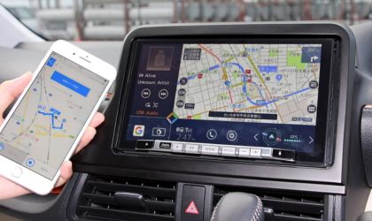
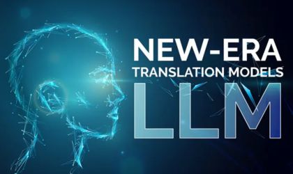
Voice‑powered real‑estate insights using LLMs, optimized for in‑vehicle hands‑free interaction.
Real Estate Portfolio
Multifamily communities, DaVita Medical Centers, Development Sites, and Luxury Housing. Owned and operated across primary markets.
Data Licensing (23 Auto Makers)
Real-time climate, property and navigation data licensed to global automotive leaders for Level 4/5 autonomous experiences.
Hospitality & Subscription
Exclusive Access to 10,000+ Global Destinations through Marriott Bonvoy, Hilton Grand, Luxury Premium Hotels, Resorts, Rental Villas & Golf Courses Worldwide.
Find Your Commercial and Residential Real Estate Data?
With 7+ years of innovation. We deliver conversational AI, real‑time satellite imagery, and real estate data integration for Level 4/5 autonomous vehicles.
Processes IDX, SEO, satellite, and property data to structure the foundation of all predictive models for 40+ asset classes.
PHYSICS LAB
Applies material & environmental physics to assess structural integrity and climate impact on real estate assets.
NEURAL NETWORK LAB
Deep learning algorithms uncover patterns in climate and market data to enable predictive outcomes for investors.
LOGIC & REASONING LAB
Ensures AI transparency and delivers explainable future outcomes for climate resilience and investment decisions.
CLIMATE DATA INTELLIGENCE
Advanced Predictive Models
Prepare for Extreme Weather Conditions · Provide Asset Classes with Future Outcomes
Advanced Predictive Model
Neural networks process 15B+ daily data points to forecast climate patterns with high-confidence forecasts for all 40+ asset classes.
Extreme Weather Preparedness
Real-time alerts and mitigation strategies for floods, wildfires, and storms. Protect your assets before disaster strikes.
Future Outcomes
Long-term climate projections for 10, 20, and 50 years. Essential for development sites, luxury housing, and commercial assets.
View Global Data at your fingertips.....
Global Team
Elite Talent · Worldwide
Vision Tech assembled an Elite Team of Professionals with end-to-end Talent Skills
USA
Nepal
India
UK
Portugal
Got Questions?
FAQ
About our conversational AI, satellite integration, and autonomous vehicle data licensing.
1. What exactly is Vision Tech building?
Vision Tech is developing an advanced conversational AI model powered by real‑time real estate data and satellite imagery. The system runs on dedicated semiconductor AI microchips and is designed for integration into Level 4/5 autonomous vehicles, enabling hands‑free property queries during travel.
2. How does satellite imagery integrate with vehicles?
We embed global satellite feeds directly into the vehicle’s navigation system. Occupants can see a live satellite view of any property, combined with parcel data and real‑estate insights — all accessible through voice commands.
3. Which automakers are you working with?
Vision Tech is aligned with 23 automakers globally for Level 4/5 data licensing. Our technology is designed to integrate seamlessly into their next‑generation autonomous vehicle platforms.
4. What makes your conversational AI different?
Our LLM is specifically fine‑tuned on real‑estate data and optimized for low‑latency, hands‑free use inside vehicles. It runs on dedicated AI microchips to ensure instant, accurate responses without relying on cloud connectivity.